The project Pilot location
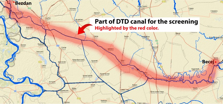
The pilot considers scanning the area from city of Bezdan to all the way to Bečej, following canal Dunav-Tisa-Dunav. Sampling consider taking 120 samples of water from the canal and 200 samples of soil adjacent to the canal, from locations where which use water from the canal for irrigation of arable land.
Samples will be analyzed for presence of Contaminants of Emerging Concern (CEC). First will be generated a Top List of CEC, with most frequent compounds, on which further analysis and recommendations will be focused in the project. Data on CEC qualitative and quantitative analysis will be the main source of data for modeling of pollutants spread, along with terrain data mainly from satellite images, but also from the field.
Along with this, a portable Membrane Inlet Mass Spectrometer (MIMS) will be constructed and deployed to monitor and identify presence of volatile organic compounds. Such approach all methods of data gathering from the field and their usage, will provide a system combining laboratory and field analysis with advanced data processing for an important task risks prediction from dangerous pollution spread from human activity, mainly industrial or urban area waste.
For sampling and assessment of “Hot Sport” most prone to pollution impact multiple features are carefully considered
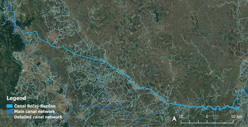
Canal network
- Main and secondary canal network
- Presence of urban regions
- Presence of industry near canal
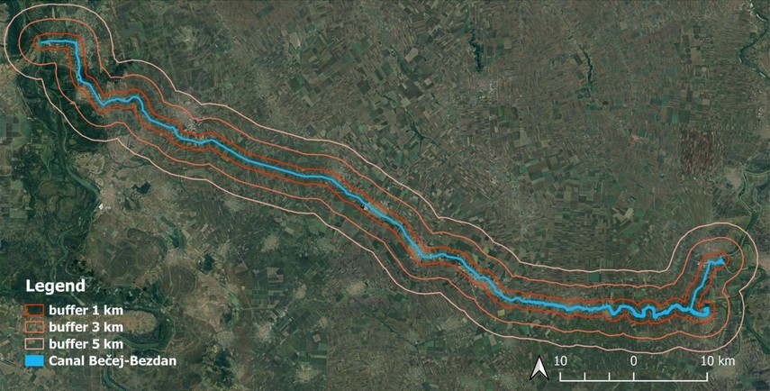
Surrounding land
- Used agricultural land identified
- Irrigated arable lands scanned
- Limiting area 5k from the canal
- Weather and soil data acquired
- Open and in-house databases used
